Territory
Their language and identity come from the territory they occupy. Their ancestors, those who came before them and have lived on this part of the world, all rest on this territory. That is why the Atikamekw people view it as "the most sacred territory." They are aware of it and consider the legacy of the territory they now use is already promised to future generations. "The land that our ancestors received from the Creator is currenlty a loan and is destinated to our grandchildren and other generations."
The Atikamekw people feel they belong to a particular territory. It is not in their tradition to "own the earth."
The Natives, unlike white people who have settled in the territory, have never set limits or inflexible boundaries.
Territorial transmission
To ensure the integrity and totality of the territory, they resort to a so-called family and filial regime. Territorial transmission is passed on from generation to generation. A territory manager, or a clan leader may transfer responsibility for the management and control of the territory to another family member of another generation. In terms of law, the concept of "possession of territory" refers collectively and equally to all the members of a family or extended family (clan).
In this case, the members of the family belong to the territory. Atikamekw people feel they can "own territory" individually.
Occupation of ancestral territory
The banks on which docked Jacques Cartier "did not belong" to any "Iroquois" group. They occupied the southern shores of the St. Lawrence, from the height of the Great Lakes to the region (south) of Montreal, while Algonquian groups were occupying most of the eastern region of Canada and the United States.
Some of these nations, upon the arrival of Jacques Cartier on May 10th 1534, already occupied for exchanges, meetings and covenants of the summer, the banks of the Gulf and the sea; the Mi'kmaks, Malecite, Abenaki (in the southern part of the Gulf of St. Lawrence and the Atlantic Sea), Innu, Naskapi, Cree, Atikamekw and Algonquin occupied the northern part of the river and Gulf of St. Lawrence. It seems that in the Atikamekw language, the words "ACA NADA" means phonetically "Aka neta" or "Akawir neta," which means "not there." This means that the "Natives" who saw the traveler Cartier, wanted to stop him, defended him to pass and go further.
Other indicators of the Atikamekw presence that can be found on old maps dating of 1743-1744:
Also, a mention of the name « Atticamouecs » (Atikamekw), relieved of « Map of northern America to serve to the history of New France. Compiled by N. Bellin, Engineer of the King and Hydrographer of the Navy. 1743, page 1 ». Other names relieved from the "Map of the Eastern Part of New France or Canada. Dedicated to Mons. The Count of Maurepas N. Bellin - 1744 on page 438 " : the names of the OUAMACHIS and ATTICAMEOUECS river, the CAOUINAGAMIC lake and the ACOUANAGOUSIN river. (History of New France. Volume 1.)
Note : the OUAMACHIS river for the « Omaci » river, or « O-ma-chi », or « Yamachiche », river on the north shore of the St.Larence river and upstream from Trois-Rivières. The name ATTICAMEOUECS, for Atikamekw or, plural, Atikamekokw, nation whose territory is located mostly in the administrative territory of Mauricie, a part in Quebec, the Laurentians and Lanaudière.
CAOUINAGAMIC lake, for « Ka winakamik » in the Atikamekw language, is located in the Tapiskwan River area or river St-Maurice, at the height of Kokac (or Coucoucache), near the Flamand river in the McTavish.
The ACOUANAGOUSIN river, for the term « Acohanakosin », would be in the Atikamekw language too. Unfortunately the geographical name is not yet listed in the study of geographical names of the territory of Atikamekw (Region Center of Quebec).
Atikamekw presence in Matawak (or Saint-Michel-des-Saints)
By their way of life, the presence of the Atikamekw people in the Matawa region (Saint-Michel-des-Saints) dates of the last two centuries. Their territory also extends to other parts of administrative regions. Of all time, taking into account the basic resources that conceal their lives, such as ash (akimaskw), this region was occupied and inhabited by people of Manawan over their travels. In some territories of Native nations, there are resources that are not available, some are easier to find and therefore to name and designate. The Atikamekw language is very descriptive and we find in their vocabulary all the names of these resources and living environments (geographical names).
The proof is found in writings dating back to the seventeenth century; these few names: Ouareau or Outaragawe sipi (Assomption River) in the Jesuit Relations of the seventeenth century. The Matawa, (although written in different ways) in the installation history of the two main villages of the area (Saint-Ignace and Saint-Michel) and in the Journal of the Hudson's Bay Company (installed in Manawan or Metapeckake in the 1870s), is an evidence of this sector. Other indicators of the presence (contemporary) of the Atikamekw people in Saint-Michel-des-Saints were relieved by oral tradition which states that families in Manawan attended in the early 1900s, the services of the holiday season.
Geographical situation of Manawan
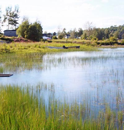
Manawan is situated west of La Tuque, north of Saint-Michel-des-Saints and of Saint-Jovite and northeast of Mont-Laurier. The main rivers that descend from the Manawan area are: the Vermillon river (Acopekahi sipi) that flows east of the St-Maurice river (Tapiskwan), north of La Tuque, towards the south is the Ka Minictikowok river (Center) that flows in direction of St-Michel-des-Saints, and from there towards the St-Maurice river (Tapiskwan) in Mattawain south of La Tuque, also towards the south, the Sesekatiko Sipi joins the Rouge river, passing around Saint-Jovite, and flowing towards the Lac-des-Deux-Montagnes. The « Wito Sipi » or the « Chatillon » taking its sources from the Otcapan Sakihikanik (Bélisle Lake) and flows into the Wapoc Sipi (The Hare) and this last one flows towards the Outaouais river at the height of Gatineau, the Manawan river, passing in the village of Manawan, descends, in direction of the north to the St-Maurice river (Tapiskwan) at the height of Wemotaci or Sanmaur (north of La Tuque).
The members of the Atikamekw Nation inhabit the territory that is the center region of the province of Quebec. The Manawan Atikamekw territory is covered by some parts of the non-native administrative regions (composed in 1970-80) of Mauricie, Haute-Mauricie, Lanaudière and Hautes-Laurentides.
The territory of the Atikamekw Nation covers the following area:
From east: starting from Quebec city, through the limits of the northern slopes for Lac Saint-Jean, in the region of Édouard lake, near La Tuque (North-East), From north: on the edge of the slope of the Ashuapmuchuan river (which flows into the Saint-Jean lake, by the limit of the slope of the James Bay region (you go up a river and after a certain time, you realize you go down the same river), from west: in the eat region of Senneterre in Abitibi, passing the head of Gatineau river (Katino Sipi), gowing down toward the south passing at the center of Mitchinamécus lake (Mitcinamekos) and passing by the Tapani lake , near Ferme-Neuve in the Hautes-Laurentides, from south: passing north of Mont-Laurier (Mos Powactikw : Moose rapids), bordering villages like Saint-Jovite and other municipalities of the regions of Hautes-Laurentides and Moyennes-Laurentides. Ouareau River would be the limit of the Atikamekw territory. The word "Ouareau" suggests the meaning "distant", as the distance crosses the river from its source to its tributary. The other meaning of this name suggests the name of the otter tail "Nikikw waro". Also, in the word "Ouareau" (or Warowik Nikikw waro), there is the letter "r" that only Atikamekw people use in their language, compared to all other Native groups of the region or the province of Quebec. This name somewhat confirms that this river crosses the ancestral lands of the Atikamekw.
Two great wealth: the memory and the meanings and the respect for the territory
In the life of Atikamekw people, as in the one of other Native nations of this continent, there are several resources including memory and meaning, and also respect they have toward the land and its resources. It was like this during their life, and survival times, like today. This is why they use these elements wisely.
The Atikamekw, like other Native nations of the continent, respect the global environment as the natural and vital energy that emanates from it; fire (thunder), wind, air and water. River rafting, slash-and-burn agriculture, when the hunter is waiting for a favorable wind for moose hunting, for example, are uses of energy. They use these energies provided that there are no major impacts. Because of the respect they devote to their environment, it is not in their plan to control and manage these natural elements.
If environment is not well managed consequences may arise, such as pollution, which can be harmful to the set of all community resources, both human and physical. Seniors in Manawan first found out about pollution of land and resources during their visit to the museum in May 2004: "... all kinds of objects from different eras, such as birch bark baskets. The in-depth examination of these containers, comparing with other similar containers, but more recent, tell a lot, for example, on the extent of the pollution that affects all local resources such as bark, roots or cedar, and judge the quality and alterations to those resources. »